


This page is dedicated to providing the most current and up-to-date information regarding high (possible flood) and low (possible drought) water conditions.
New information will appear at the top of the page.
Visit Water Use It Wisely.com for ways you can help conserve water during drought conditions.
To be added to the River Watch newsletter email list or if you have questions regarding this information, please contact Rob Bowman, Acting Community Emergency Management Coordinator (CEMC) at rbowman@augustafire.ca.
River Watch 2023 # 6
The Municipality of Augusta has been advised by the International Lake Ontario–St. Lawrence River Board and International Niagara Board of Control that they will host two virtual public meetings, one in English and one in French, to share the most up to date forecast for the Lake Ontario and St. Lawrence River basin and discuss ice boom installation for the upcoming winter. The Boards have indicated that these meetings are essential to provide information on water levels and flows, operational decisions by each Board, and hear from members of the public to better understand the impacts current water levels have on their community.
A question-and-answer session will follow the presentation. If you would like to participate, please register in advance to participate. If you have any questions or comments, please submit them during the registration process. Registration will close at 5:00 pm the day before the scheduled meeting.
The English meeting will be Wednesday, August 30 from 5:30 pm to 6:30 pm. Registration is available at the below link: https://register.gotowebinar.com/register/8243443726943828311
The French meeting will be Thursday, August 31 from 5:30 to 6:30 pm. Registration is available at the below link: https://register.gotowebinar.com/register/7590494348830240602
Contact information for the International Lake Ontario-St. Lawrence River Board is as follows:
If you need any assistance with this process, please contact emerplan@augusta.ca
Thank you.
Posted August 24, 2023
River Watch 2023 # 5
Did you have any St. Lawrence River shoreline damage in 2022 or 2023?
The Great Lakes-St. Lawrence River Adaptive Management Committee (the GLAM Committee) has asked municipalities to share two questionnaires with our residents who may have been affected by either the 2022 or 2023 water levels on the St. Lawrence River. Through the questionnaires, the Committee hopes to better understand vulnerable shoreline areas and to predict possible impacts under a range of potential future water level conditions.
A copy of the GLAM letter and the links to the two questionnaires are enclosed. If possible, please share this information with your neighbours who are not on the River Watch subscribers list.
GLAM Committee Letter:
The Great Lakes-St. Lawrence River Adaptive Management Committee (the GLAM Committee) is seeking input from property owners along the Great Lakes and St. Lawrence River shorelines who were impacted by high and/or low water levels in 2022 and/or 2023.
Please share these questionnaires with your community to assist the GLAM Committee to better understand vulnerable shoreline areas and predict possible impacts under a range of potential future water level conditions.
The survey should take about 10 minutes to complete and will be open until further notice.
2022 Water Level Impacts Questionnaire
- English: surveymonkey.com/r/GLAM2022
- French: surveymonkey.com/r/GAGL2022
2023 Water Level Impacts Questionnaire
- English: surveymonkey.com/r/GLAM2023
- French: surveymonkey.com/r/GAGL2023
The GLAM Committee looks forward to receiving responses that reflect the local concerns of property owners along the diverse shoreline of the upper Great Lakes, Lake Ontario and the St. Lawrence River. The GLAM Committee will use your input to better understand water level impacts seen in individual communities. The information you share will also help to assess the performance of the regulation plans that are used to manage outflows from Lake Superior and Lake Ontario.
Since natural factors such as the amount of precipitation are the primary drivers of water level changes and extreme water levels, adjustments to the Lake Superior or Lake Ontario outflow regulation strategies are unlikely to be able to eliminate the chance of similar impacts occurring in the future. However, understanding what the primary concerns are from property owners and ensuring the simulation models used by the GLAM Committee accurately reflect those issues is critical for the Adaptive Management process.
For more information on the questionnaire please visit: ijc.org/glam/respond-questionnaires. You can also reach out to the Committee by email glam@ijc.org if you would like more information or you can visit their website: ijc.org/glam.
IJC Great Lakes-St. Lawrence River Adaptive Management Committee
Posted August 1, 2023
River Watch 2023 # 4
Water Level Update
On Thursday, May 04, the ILOSLRB released the attached graphic which highlights inflows and outflows for those watercourses impacting the St. Lawrence River. The graphic is effective as of May 03. This graphic/chart will give you some idea of why water levels on the St. Lawrence are rising and potentially threatening your properties.
Lake Ontario outflow at the Moses-Saunders Dam (M/S) is shown as being 5,900 cubic meters/second. Flows were further reduced on May 04, to 5,750 m3/sec. Since then, the outflow from the Ottawa River has declined (peaked on May 05) and the Board, as of yesterday evening, has brought the outflow at M/S up to 7,400 m3/sec.
The second major factor affecting levels on the river is the inflow into Lake Ontario. The other Great Lakes inflow enters the lake via the Niagara River. Inflows from rivers, streams and precipitation within the Lake Ontario watershed further add to the level of the lake. As you will note, the combined inflow or supply was 10,510 cubic meters/second. The lake inflow exceeds the outflow at Moses/Saunders, therefore water levels on both the lake and river keep going up. The risk of flooding will be dependent on the Board being able to increase the outflow at the M/S Dam to reflect the inflow more closely. Another major factor would be a precipitation event like what we experience in late April. That might increase flows on the Ottawa River and thereby force the Board to again reduce outflows at the Moses-Saunders Dam.
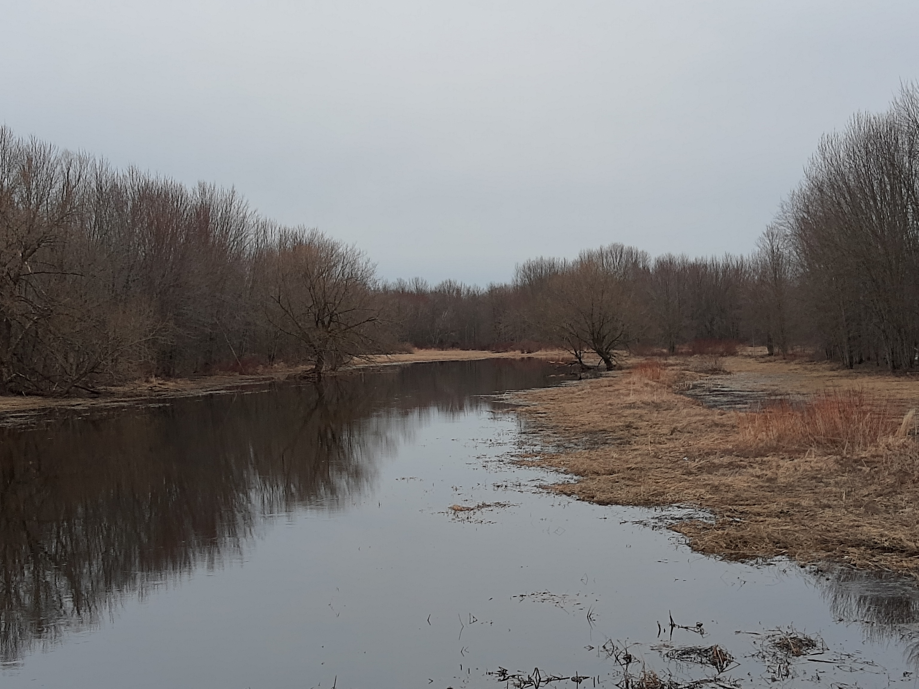
At the present time, the river level in Augusta is 11.5 inches above what it was on April 21, 2023. That level is without any wind surge. Township staff will continue to monitor river level conditions to keep residents informed.
Should conditions further deteriorate, residents will be advised of the procedures regarding the availability of sand and sandbags. If you have any questions with respect to this bulletin, please email Hans Werner-Mackeler, Community Emergency Management Coordinator at emergplan@augusta.ca.
Posted May 9, 2023
River Watch 2023 # 3
Conservation authorities and the MNRF had just started to indicate water levels on the Ottawa River and the Great Lake’s tributaries were starting to recede when the latest round of inclement weather moved into Ontario and Quebec on Sat. April 29th. Meteorologists are estimating that around 50-70mm of precipitation may occur from this event. As an example, from April 29 to May 2, Brockville received 62.1mm (and it is still raining). With that amount of precipitation, Lake Ontario levels will rise, as will the level of the St. Lawrence River. The municipality will be closely monitoring the situation.
We Need Your Help: Water Level Survey, 2023
With both the 2017 and 2019 flood events, we know what the peak elevation of the river in Augusta Township each year was. We do not however, have an accurate idea of when properties along the river were first affected. Should our levels rise to a point where your property is impacted (i.e., shoreline damage, flooded weeper beds, flooded infrastructure (boathouse, sheds, residence), etc., we would greatly appreciate receiving an email from you when the damage is first noted. That information will allow us to set an elevation point for the occurrence. With that knowledge we will be able to keep residents better informed as levels go up and respond more quickly to the need for sand and sandbags. Please email emergplan@augusta.ca if damage starts to occur to your property or perhaps to that of a friend or neighbour.
The week of May 07-13 is Emergency Preparedness Week across Canada. The Township’s Facebook page will be posting information on how you and your family can be prepared for emergency events such as inclement weather and flooding. Visit our website’s Emergency Preparedness page for more detailed information.
Posted May 3, 2023
River Watch 2023 # 2
Snow melt in the upper reaches of the Ottawa River has resulted in flooding along the lower reaches (Ottawa area) and increased inflow into the St. Lawrence River.
Flooding, also due to melting snow, is occurring in some of the watersheds flowing into the Great Lakes. Those increased flows will work their way down to Lake Ontario and cause the lake level to rise, thereby increasing outflows into the St. Lawrence River.
As a result of these changes, residents along the river may start to notice increased water levels beyond the present elevations. At this time, every indication is that the increased levels will be minor in nature and not of a long-term duration that could cause flooding. Municipal staff will continue to monitor the situation and will advise residents if conditions change.
Posted April 18, 2023

Flood Watch Statement From South Nation Conservation
FLOOD WATCH STATEMENT – IN EFFECT UNTIL APRIL 12th
ACTION: Residents are advised to exercise extreme caution when near rivers and waterbodies due to increasing river flows and slippery conditions. Parents are encouraged to explain these dangers to their children.
Residents in flood prone or low-lying areas, historically susceptible to flooding, should take the necessary precautions to protect their property. Please ensure:
- Sump pump is clear, in good working condition and has a backwater valve on it.
- Easy access to portable backup generator and pump.
- Downspouts are clear and the outlet is at least 3 m from the dwelling.
- Driveway culverts are clear of debris and drain well.
- Securing items that might float away as flows increase.
For more information: http://ow.ly/atkR50NCgnQ
Posted April 6, 2023

Water Safety Statement from South Nation Conservation
Environment Canada is forecasting 20 to 30mm of rain across the jurisdiction starting Friday and continuing into Saturday. Daytime temperatures are forecast to be above freezing on Saturday contributing to snow and ice melt.
Precipitation and snowmelt will increase water levels and flows in rivers, streams and drains, potentially causing nuisance flooding in low-lying areas. It may also result in fast flowing water and slippery or unstable banks.
Residents are advised to exercise extreme caution when near rivers and waterbodies due to increasing flow and slippery conditions. Parents are encouraged to explain these dangers to their children.
Residents in flood prone or low-lying areas, historically susceptible to flooding, should take the necessary precautions to protect their property. Please ensure:
- Sump pump is clear, in good working condition and has a backwater valve on it.
- Easy access to a portable backup generator and pump.
- Downspouts are clear and the outlet is at least 3 m from the dwelling.
- Securing items that might float away as flow increase.
For more information about dealing with flooding, please visit SNC’s website at www.nation.on.ca or Augusta Township’s emergency preparedness page at https://augusta.ca/life-in-augusta/emergency-preparedness/
Posted March 31, 2023
River Watch 2023 # 1
Effective today, March 06, 2023, the International Lake Ontario-St. Lawrence River Board has authorized a minor deviation from Plan 2014. Flows at the Moses-Saunders Dam will be reduced by approximately 2,000 cubic metres/second until March 12th to facilitate a concrete inspection at a dam on the river in Quebec. To offset this deviation, outflows will be increased from March 13 through the 24th, as conditions allow. Due to the temporary reduced outflow, those living along the river may notice a slight rise in water levels. Those levels should recede once the outflow has been increased.
Municipal staff will continue to monitor conditions and will advise residents accordingly.
Posted March 6, 2023
South Nation Conservation Authority Watershed Conditions: Flood Watch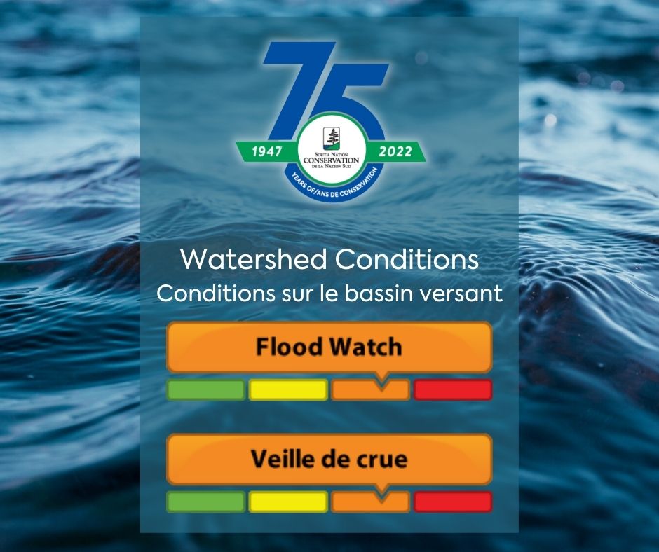
Environment Canada is forecasting mild temperatures throughout the week, reaching daytime temperatures of 8 o C, and the potential for significant periods of rain towards the end of the week and into the weekend totaling up to 40 mm by Saturday, March 26th.
As a result of updated rainfall amounts in the forecast, and the potential for increased water levels, South Nation Conservation (SNC) is upgrading from a FLOOD OUTLOOK to a FLOOD WATCH.
With water levels already elevated, and increased runoff expected to continue due to warmer temperatures, ongoing snow melt, and additional forecasted rainfall, the risk of flooding in areas adjacent to watercourses is heightened. Rising water levels and flows will create hazardous conditions close to any river, stream, or waterbody in the South Nation River watershed.
Residents are advised to exercise extreme caution when near rivers and waterbodies as the forecasted weather may rapidly increase river flows and cause slippery conditions. Parents are encouraged to explain these dangers to their children.
Visit the South Nation Conservation Authority’s website to read the full statement.
Posted March 24, 2022
South Nation Conservation Authority Watershed Conditions: Flood Outlook (Update #1)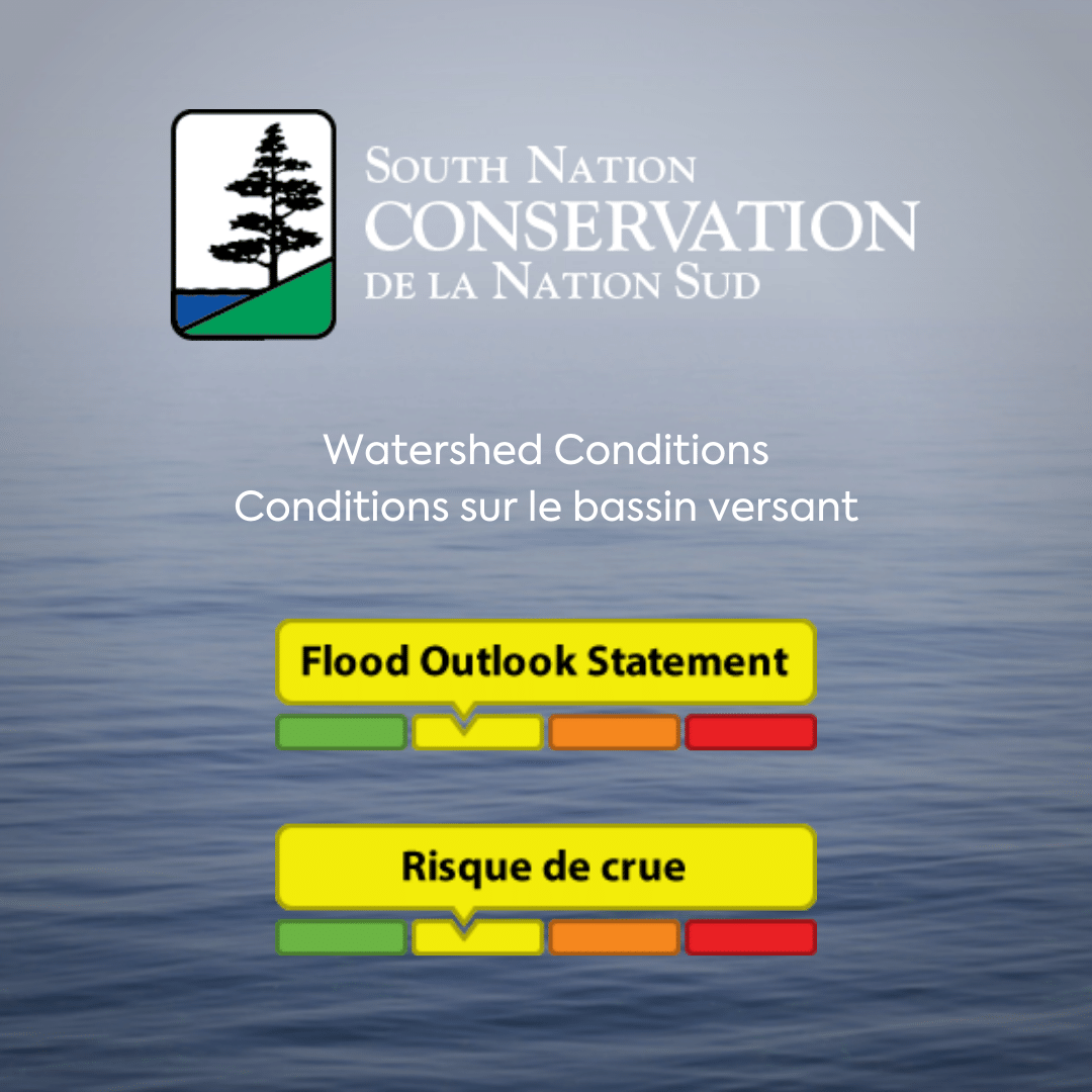
Environment Canada is forecasting milder temperatures throughout the week, reaching daytime temperatures of 8 oC, and periods of rain towards the end of the week and into the weekend totaling up to 17 mm by Saturday, March 26th.
Warmer temperatures, snow melt and rainfall will maintain the current high water levels and may result in nuisance flooding in low-lying areas across the jurisdiction. Unstable ice conditions will also result from warmer temperatures and higher flows.
Residents are advised to exercise extreme caution when near rivers and waterbodies as the forecasted weather may rapidly increase river flows and cause slippery conditions. Parents are encouraged to explain these dangers to their children.
Visit the South Nation Conservation Authority’s website to read the full statement.
Posted March 23, 2022
South Nation Conservation Authority Watershed Conditions Statement
Environment Canada is forecasting milder temperatures through the week, reaching daytime highs of 8 to 15 oC, and rainfall over the weekend totaling up to 50 mm by late Sunday, March 20th.
Runoff is expected due to warmer temperatures, melting snow, and forecasted rainfall. This will lead to increased water levels and flows across the SNC jurisdiction. Ice breakup is also expected.
Warmer temperatures, snow melt and rainfall will produce higher water levels and possible nuisance flooding in low-lying areas across the jurisdiction. Unstable ice conditions will also result from warmer temperatures and higher flows.
Residents are advised to exercise extreme caution when near rivers and waterbodies as the forecasted weather may rapidly increase river flows and cause slippery conditions. Parents are encouraged to explain these dangers to their children.
Visit the South Nation Conservation Authority’s website to read the full statement.
March 16, 2022
Rideau Valley Conservation Authority Watershed Conditions Statement
Warm temperature and potential rain may raise water levels in local watercourses and pose a safety hazard.
Visit the Rideau Valley Conservation Authority’s website to read the full statement.
Posted March 15, 2022
River Watch 2022 # 1
Unlike last year at this time when levels were drawn down below its long-term average, Lake Ontario presently (Feb. 17) is at 0.21 metres (9.69 inches) above normal. Outflows have been increased for some time in accordance with Plan 2014. Inflows, heavy rain, and runoff may change the situation this spring.
The International Joint Commission (IJC), in February 2020, initiated a review of the outflow management plan (Plan 2014) for Lake Ontario. Phase 1 of the project, called the Expedited Review of Plan 2014, focused on providing information quickly enough to aid the response to any near-term recurrence of extreme high-water events. The IJC had indicated that the evidence was clear that natural factors and weather patterns caused the high-water conditions in 2017 and 2019. However, the IJC ordered the expedited review based on stakeholder requests to determine if Plan 2014 may also have played a role.
The Expedited Review of Plan 2014 has been released and is open to public feedback for a 60-day period (ending April 18th). If you would like to keep in touch with this process, please follow along at http://ijc.org/en. I’ve included a copy of the report for your reference.
If you would like to be added to the River Watch bulletins, please send an email to emergplan@augusta.ca.
Posted February 22, 2022
Level 1 Low Water Advisory Terminated for South Nation River Watershed
On November 2nd, 2021, South Nation Conservation’s (SNC) Water Response Team voted to terminate the Level 1 Low Water Advisory across the South Nation River Watershed.
A Level 1 Low Water Condition was initially declared on June 4th, 2021, due to a drier than usual spring, persistent hot temperatures, and lack of precipitation throughout the months of May and June. Above average rain received throughout the month of July aided in restoring river flows and precipitation amounts to normal conditions, supporting the Water Response Team’s action to lift the Level 1 Low Water Advisory on August 4th, 2021. However, due to sporadic rainfall and low river flows, the Water Response Team voted to reinstate the Level 1 Low Water Advisory across the South Nation Watershed on September 9, 2021.
Read the full notice on the South Nation Conservation Authority’s Website.
Posted November 4, 2021
Watershed Conditions: Water Safety Statement from the South Nation Conservation Authority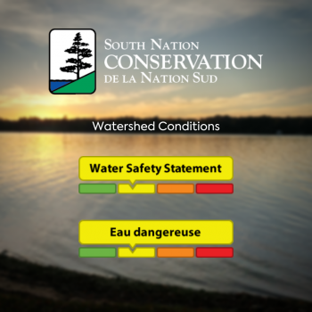
Weather Forecast:
Rainfall amounts are forecasted to reach up to 60 mm by early Sunday morning.
Environmental Conditions:
The South Nation River Watershed is currently in a Level 1 Low Water Condition; however, river flows are expected to increase quickly due to expected rainfall.
Risks:
Rainfall is likely to produce higher water levels and possible nuisance flooding in low-lying areas across the jurisdiction.
ACTION:
Residents are advised to exercise caution when near rivers as the forecasted weather may rapidly increase river flows and cause slippery riverbanks. Parents are encouraged to explain these dangers to their children.
Duration:
This water safety statement is in effect until Tuesday, October 19, 2021 at 5 PM or until an update has been issued.
To read the full statement, visit the South Nation Conservation Authority’s website.
Posted October 15, 2021
Low Water Status Returned to “Normal” in Rideau Valley Watershed
Watershed conditions in the Rideau Valley Watershed have returned to “Normal’ under the Ontario Low Water Response Program.
With above average rainfall amounts across the watershed over the last month, stream flows and water levels have recovered from the previous low water status and are now above average for this time of year.
To read the complete statement, visit the Rideau Valley Conservation Authority website.
Posted October 6, 2021
Watershed Conditions: Water Safety Statement from the South Nation Conservation Authority
Weather Forecast:
Environment Canada is forecasting rainfall amounts of 40 to 60 mm by early Friday morning.
Environmental Conditions:
The South Nation River Watershed is currently experiencing a minor drought (Level 1 – Low Water Condition), with river flows that are below normal for this time of year. Water flows are expected to increase over the coming days with the forecasted rainfall.
Risks:
Rainfall is likely to produce higher water levels and possible nuisance flooding in low-lying areas across the jurisdiction.
ACTION:
Residents are advised to exercise caution when near rivers as the forecasted weather may rapidly increase river flows and cause slippery riverbanks. Parents are encouraged to explain these dangers to their children.
Duration:
This water safety statement is in effect until Monday, September 27, 2021, at 5:00 PM or until an update has been issued.
SNC monitors the water levels and weather forecasts as part of the Flood Forecasting and Warning Program. Updates are provided as conditions change.
Please visit www.nation.on.ca for more information. To provide feedback with respect to changes in water related conditions please email waterwatch@nation.on.ca, post on our Facebook (/SouthNationConservation) or Twitter (@SouthNationCA).
FOR MORE INFORMATION: Katherine Watson, Water Resources Specialist – Monitoring, 1-877-984-2948, kwatson@nation.on.ca.
To read the statement, visit the South Nation Conservation Authority’s website.
Posted September 23, 2021
Watershed Conditions Statement from the Rideau Valley Conservation Authority
Environment Canada is forecasting rainfall amounts of 60 to 90 mm starting today through early Friday morning, with a few localities possibly exceeding 100 mm. The higher amounts are forecasted for the upper part of the Rideau Valley Watershed. This widespread rainfall event is due to a cold front and a moisture-laden low pressure system that will arrive from the American Midwest.
Because the Rideau Valley Watershed is currently in a “minor low water condition,” all water levels and flows are currently below normal, so significant flooding is not expected. However, this large rain event will cause all water levels and flows to increase rapidly and could cause localized flooding in small watercourses, urban areas and ditches.
The RVCA reminds the public to exercise extreme caution around all waterbodies and remind children about the dangers of playing near open water. Residents are reminded to make sure their sump pumps are in good working condition and to help reduce ponding by keeping ditches, culverts, and storm drains clear of obstructions.
This watershed conditions statement is in effect until Tuesday, September 28, 2021 at 5 PM or until an update has been issued.
To read the statement, visit the Rideau Valley Conservation Authority’s website.
Posted September 22, 2021
Level 1 Low Water Advisory for the South Nation River Watershed
South Nation Conservation’s (SNC) Water Response Team voted to reinstate the Level 1 Low Water Advisory across the South Nation River watershed on September 9th, 2021,
due to sporadic rainfall and low river flows.
Visit the South Nation Conservation Authority’s website to read the full statement.
Posted September 13, 2021
Minor Low Water Conditions Persist Due to Warm, Dry August
The Rideau Valley Water Response Team is maintaining a MINOR low water status for the Rideau River watershed after officials met to discuss conditions on Wed. Sept. 8. This low water status is a result of a warm and dry August.
Watershed residents and businesses are encouraged to voluntarily reduce their water usage by 10 percent. This is especially important for those who have water-taking permits from surface or groundwater sources, as well as residents on private, communal, or municipal wells.
Visit the Rideau Valley Conservation Authority’s website to read the full statement.
Posted September 9, 2021
Despite recent rain, minor low water conditions continue in Rideau Valley Watershed
August 10, 2021
Despite recent rain, the Rideau Valley Water Response Team is maintaining a MINOR low water status for the Rideau River watershed after officials met to discuss conditions on Tuesday, August 10.
Watershed residents and businesses are encouraged to continue to voluntarily reduce their water usage by 10 percent. This is especially important for those who have permits for taking water from surface or groundwater sources and all residents on private, communal or municipal wells.
Visit the Rideau Valley Conservation Authority’s website to read the full statement.
Posted August 10,2021
Low Water Advisory Ended for South Nation River Watershed
South Nation Conservation’s (SNC) Water Response Team has terminated the Low Water Advisory across the South Nation River watershed, effective Wednesday, August 4th, 2021.
Visit the South Nation Conservation Authority’s website to read the full media release.
Posted August 5, 2021
‘Minor’ Low Water Conditions Persist in Rideau Valley Watershed
July 6, 2021
The Rideau Valley Low Water Response Team is maintaining a MINOR low water status for the Rideau River watershed after officials met to discuss dry conditions on Tuesday, July 6.
Visit the Rideau Valley Conservation Authority’s website to read the full statement.
Posted July 6, 2021
Level 1 Low Water Condition Maintained for South Nation River Watershed
July 6, 2021
Despite the rain received in the month of June, South Nation Conservation’s (SNC) Water Response Team upheld a Level 1 Low Water Condition for its entire watershed in Eastern Ontario on June 30, 2021.
Visit the South Nation Conservation Authority’s website to read the full statement.
Posted July 6, 2021
Minor Low Water Conditions in Rideau Valley Watershed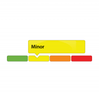
June 8, 2021
Due to below average rainfall over the last three months, conditions in the Rideau Valley Watershed now meet the threshold for Minor Low Water status under the Ontario Low Water Response Program.
Visit the Rideau Valley Conservation Authority’s website to read the full statement.
Posted June 8, 2021
South Nation Conservation Declares Level 1 Low Water Condition
June 4, 2021
Despite the rain received last week, South Nation Conservation (SNC) has issued a Level I Low Water Condition for its entire watershed in Eastern Ontario. The Level 1 Conditions was declared due to a drier than usual spring and a general lack of precipitation. To learn more, please visit the SNCA’s website.
Posted June 7, 2021
RIVER WATCH 2020 # 7
The attached release from the International Joint Commission indicates that the Commission has approved increased St. Lawrence River flows in January and February of 2021. Any continuation of those flows into March and beyond will require further Commission approval. However please note the qualifier highlighted in yellow.
Prepared: December 16, 2020
The International Lake Ontario- St. Lawrence River Board to Implement Strategy to Deviate from Plan 2014 this Winter
Date: December 11, 2020
The International Joint Commission (IJC) has approved the Board’s request for authority to deviate from Plan 2014, and as conditions permit, outflows from the Moses-Saunders dam on the St. Lawrence River can be increased to exceed Plan 2014 flows.
The risk of high water on Lake Ontario in 2021 is moderate due to persistent high-water levels on Lake Erie and the upper Great Lakes. This will cause inflows to Lake Ontario from Lake Erie to remain high over the coming winter months. The main driver of a high-water event in the Lake Ontario basin will depend on seasonal factors such as precipitation and snowpack runoff.
Since June, Lake Ontario levels have steadily declined to just above the seasonal long-term average. Levels remain well below those that would automatically grant the Board the authority to deviate from Plan 2014 outflows. The Board and IJC recognize the continued threats posed by high water supplies into the system and the risk of another high-water event in 2021. The Board will implement a deviation strategy to take advantage of opportunities that may arise through the winter.
The IJC has granted this authority under Condition J of its Orders of Approval, which allows for the testing of some regulatory deviation strategies from Plan flows. This authority will begin on 1 January 2021 and continue through the end of February. This regulatory strategy will be reassessed in February and could be revised with a request for further deviation authority from the IJC should conditions warrant. During this period flow limits are expected to pertain to low Lake St Lawrence levels, municipal water intakes and river ice formation. All deviation strategies, regardless of magnitude of impact, implemented by the Board in this time frame are intended to cumulatively reduce the risk of high-water impacts and balance the interests of other groups throughout the system.
There remains considerable uncertainty in the weather and water supply conditions between now and next spring. These natural, uncontrolled hydrologic factors are the primary driver of water level fluctuations on Lake Ontario and the St. Lawrence River. If basin conditions are extremely wet, and similar to those observed in 2017 and 2019, no deviation strategy will prevent water levels that can cause flooding and damage shoreline properties. Providing those types of benefits are beyond the reach of water regulation and are more reliably addressed through coastal resilience and planning.
Information on hydrologic conditions, water levels and outflows, including graphics and photos, are available on the Board’s website and posted to the Board’s Facebook page at https://www.facebook.com/InternationalLakeOntarioStLawrenceRiverBoard (English), and more detailed information is available on its website at https://www.ijc.org/en/loslrb.
Contacts:
Rob Caldwell: (613) 938-5864 Rob.Caldwell@canada.ca
Bryce Carmichael: (513) 418-8562 ILOSLRB-USSection@usace.army.mil
The International Lake Ontario – St. Lawrence River Board specifies the outflows from Lake Ontario, according to Plan 2014 as required in the 2016 Supplementary Order from the International Joint Commission. This plan was agreed to by the United States and Canada in December 2016 in an effort to improve environmental performance while maintaining most of the benefits provided to other interests by the previous Plan 1958-D, which was in use since 1963. In determining outflows, the Board, in conjunction with its staff, pays close attention to water levels in the Lake Ontario-St. Lawrence River system and on the Great Lakes upstream, and to the effects on stakeholders within the basin. The IJC announced that they are reducing the size of the Board from 12 members to 6 members effective 1 December, 2020. The re-structured Board will continue to include one member each nominated by the Government of Canada, the Government of the United States, the Province of Quebec, the Province of Ontario and the State of New York and will include one additional member on the US side to ensure equal membership from both countries. Board members will continue to serve in their personal and professional capacity and consider interests of the entire Lake Ontario-St. Lawrence River system. The Board’s online membership page has been updated to reflect this change. This re-structure does not fundamentally alter the process by which the Board makes regulatory decision. All 6 previous Board members have been asked to serve on an Interim Advisory Group (IAG). The IAG continues to attend meetings and their recommendations and input on regulatory decisions is still given significant weight in the Board’s final decision making process.
Water levels vary from year-to-year and throughout the year depending on weather and water supply conditions. Such variations benefit coastal wetlands and are critical to a healthy lake environment, but may at times and depending on individual circumstances increase the vulnerability of shoreline structures and reduce opportunities for recreational boating activities. The Board urges everyone to be prepared to live within the full range of levels that have occurred in the past and of those that may occur in the future. Based on historical observations and projected future conditions, at a minimum, Lake Ontario water levels are expected to range from a high of 75.92 m (249.1 ft.) to a low of 73.56 m (241.3 ft.) at infrequent intervals. However, it is also recognized that future climate conditions are uncertain, and more extreme water levels may be reached and these extremes may occur more often. Levels on the St. Lawrence River tend to vary more widely than on Lake Ontario. Also, these levels do not include the varying local effects of strong winds and wave action that significantly increase or decrease local water levels on both the lake and river, with temporary changes of over half a meter (two feet) possible in some locations.
For more information, please see the Board’s website (ijc.org/loslrb) and Facebook page (https://www.facebook.com/InternationalLakeOntarioStLawrenceRiverBoard).To receive a weekly email about water levels and flows in the Lake Ontario–St. Lawrence River system, please send a blank e-mail message to
stlaw-L-subscribe@cciw.ca with the word ’subscribe’ in the title and body of your message.
Posted December 17, 2020